21 Jun, 2023
Mapping the way to new economic opportunities
A new research collaboration led by the Cooperative Research Centre for Developing Northern Australia (CRCNA) promises to transform how digital maps are designed and used on Country – as a key enabler for long-term economic development for Northern Australia’s First Nations’ communities. The Anindilyakwa Land Council (ALC) from Groote Eylandt in the Northern Territory are leading the data charge, undertaking an ambitious plan to map their entire island archipelago with support from Geoscience Australia, Australian National University (ANU) and Aerometrex (ASX: AMX).
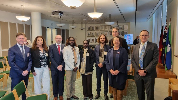
L-R Steve Masters CEO Aerometrex, Sheriden Morris Chair CRCNA, Matt Simmons Aerometrex, Josh Mamarika ALC, Danelle Barra ALC, Jonah Lafferty ALC, Rod Kennet Geoscience Australia, Hon. Minister Madeleine King, Dr James Johnson CEO Geoscience Australia
As part of the "Integrating Indigenous priorities in spatially enabled planning of the Indigenous Estate", Aerometrex are supporting the field data collection and the ANU will assess how new ways of using Geographic Information System (GIS) technology can improve the end-user experience for the ALC. Importantly, a ground-up approach will ensure traditional knowledge and information are integrated into the GIS in culturally appropriate and inclusive ways. Geoscience Australia will also explore how their data products and data sets can be utilised by the project to enrich and improve the process of accessing and using the technology in remote locations.
It’s hoped this model will support other remote First Nations communities to take up GIS mapping as a way of ensuring traditional information and knowledge is managed in a best-practice context. “This is about using modern technology to help our community make informed decisions about our economic future,” Tony Wurramarrba ALC Chairman said. Data generated during this project will be stored in the ALC’s geospatial database and can be utilised as a layer of ‘baseline’ cultural information for use by land and sea managers in the future.
Geoscience Australia Chief Executive Officer Dr James Johnson said he was excited to work alongside ALC and Aerometrex to better understand how his agency’s products could be adapted to better suit the needs of First Nations’ people. “The collaboration is a unique opportunity to inform our geoscience programs, such as Exploring for the Future, on being inclusive and relevant to First Nations Australians in their design.”
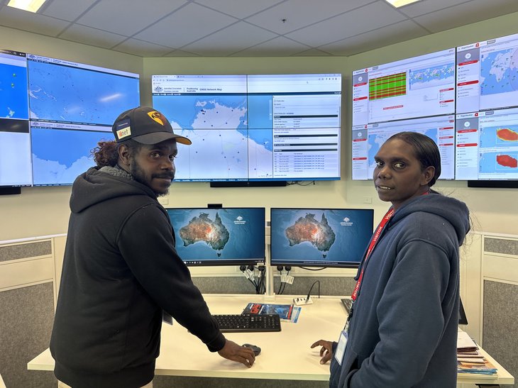
ALC's Josh Mamarika and Danelle Bara at Geoscience Australia in June 2023 >>
CRCNA Chair Sheriden Morris said to date there has been limited exploration into how geospatial tools can be applied to First Nations’- led cultural mapping practices. “It’s exciting to be investing in work which will have ongoing and tangible benefits for the community of Groote Eylandt and other communities across Northern Australia who are keen to use GIS mapping technology to unlock their economic potential for many years to come,” she said.
Aerometrex CEO, Steven Masters explains how data is one thing, but to then visualise it through spatial mapping and be able to explore those environments with the Anindilyakwa people to better understand the data in new ways and understand what that means for future development is incredible.
Speakers: Jonah Lafferty, Josh Mamarika, Danelle Bara (Anindilyakwa Land Council) and Dr Samuel Holt (Aerometrex)
Background
This project has been funded by the CRCNA as part of its $5 million "Activating the Indigenous Estate" program, which called for projects as part of an open funding call in May 2022.
The research will overcome practical barriers faced by remote Northern Territory communities in relation to access, ownership, and utilisation of spatial data for Indigenous businesses. Namely, it will provide a method and publicly available model for the integration of data relating to cultural concerns and priorities into a spatially enabling land management system. The research will address the development of local indicators, data analytics and GIS capabilities. The research will do so by directly contributing to the strength of ALC’s GIS program and by allowing for cultural data to be included in data analytics which contribute to the economic development agenda of Indigenous-controlled businesses on the archipelago.
The project will provide the people of the Groote archipelago with sovereignty over their spatial information and provide them with an avenue to access and utilize this information for strategic planning and decision-making.