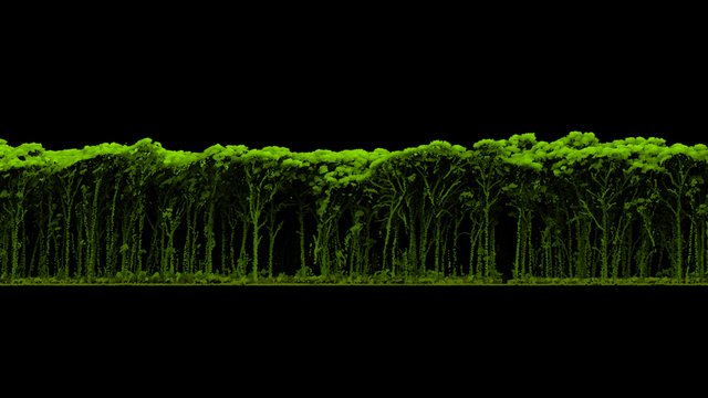
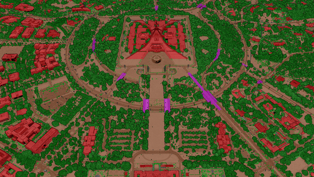
LiDAR can accurately map the distribution and 3D structure of vegetation across urban & rural areas.
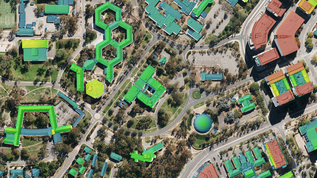
Tailored elevation data that shows the specific height of buildings and is useful for urban planning
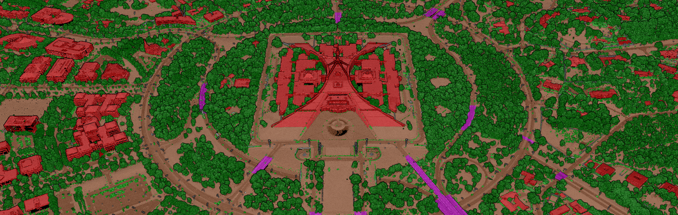
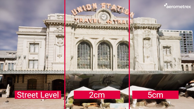
Aerometrex's LiDAR Classification Types cater to a wide range of requirements and can be tailored
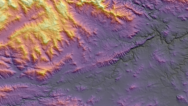
The application of Hillshade effects helps reveal topographical features in a DTM
Disclaimer: Entering your e-mail address above, you agree to receive Aerometrex's e-mail communications, which you can change/withdraw from at any time. Privacy Policy