Explore landscapes in the context of the built environment with Aerometrex's LiDAR-derived Built Infrastructure data suite. You can support your projects with raster and vector datasets that provide insights into the distribution and geometry of infrastructure and their impacts on the landscape. Also, by combining automation and manual intervention where required, your business can be assured of optimal efficiency without losing detail or accuracy. Contact us by using the form below for more details and one of our team members can reach out to understand your requirements.
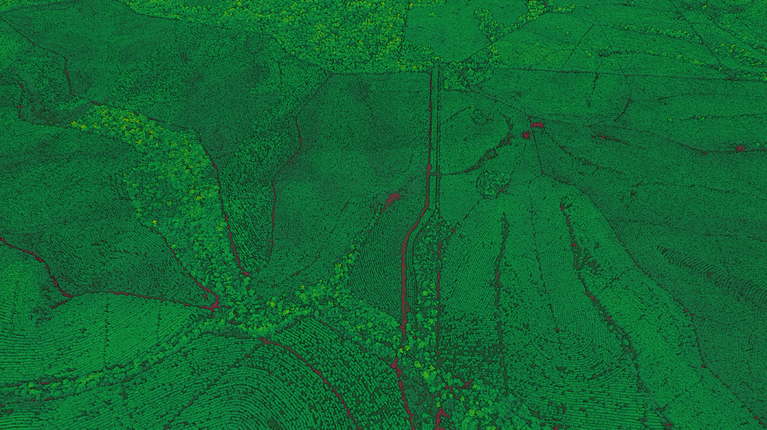
Airborne LiDAR surveys produce a holistic three-dimensional model of the landscape, including built infrastructure and assets in metropolitan, urban and rural landscapes. It is therefore possible to extract key insights about the distribution and geometry of built infrastructure in a survey area, as well as to understand their position relative to vegetation and the ground surface. Since LiDAR can penetrate through tree canopy, built infrastructure such as buildings and sheds can often be effectively identified even under tree cover.
Aerometrex’s Type 2 LiDAR point cloud classification is designed as a cost-effective method to unlock a range of built infrastructure datasets. This classification type can be optimised with targeted improvements to include information on other priority assets.
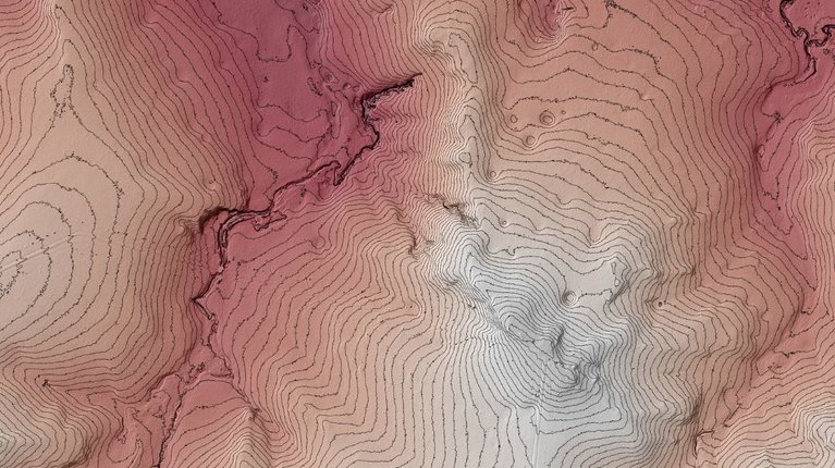
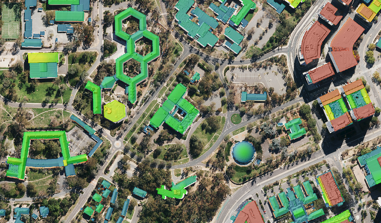
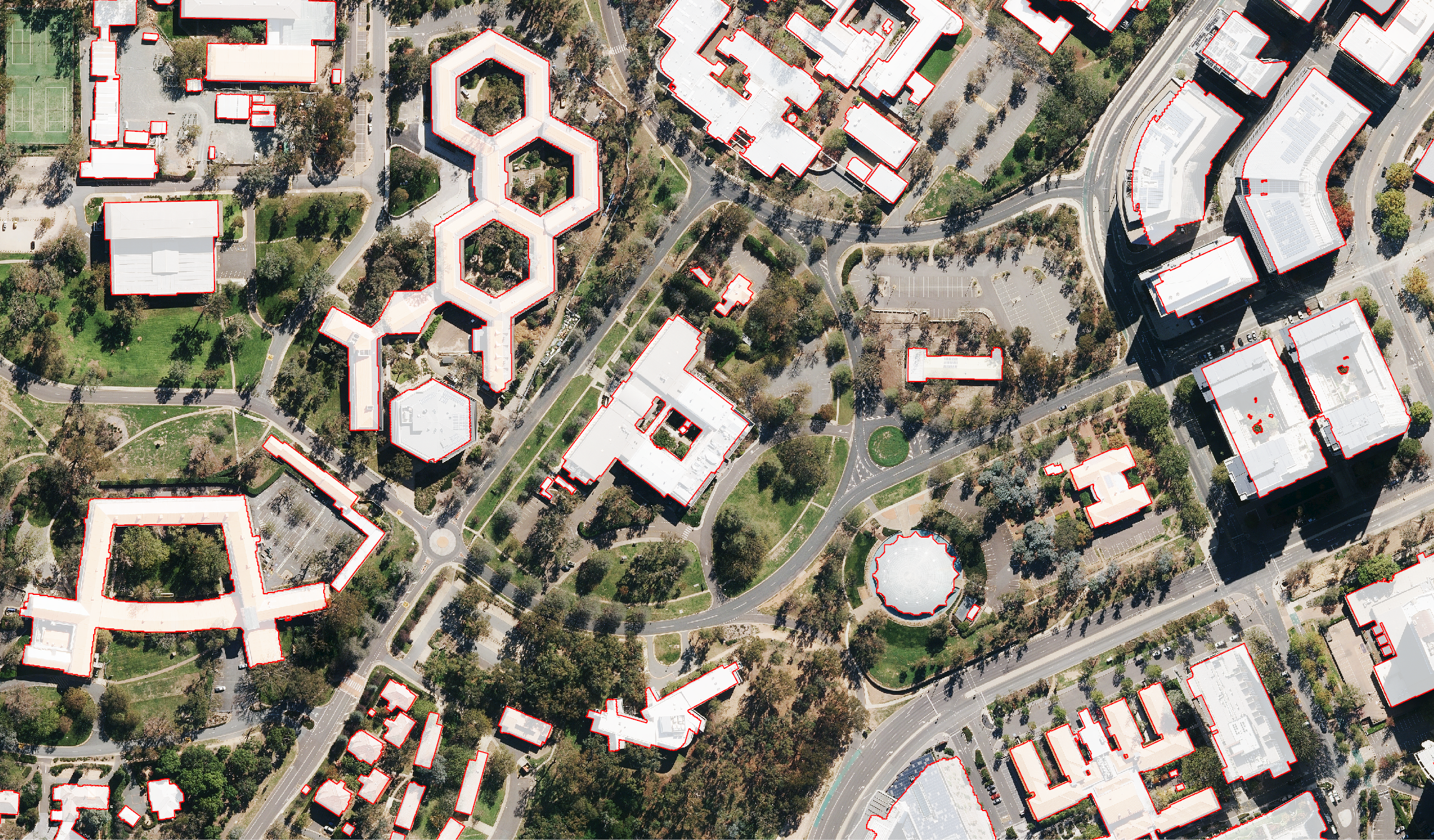
Aerometrex can provide a range of raster and vector datasets that describe the built infrastructure within a survey area. A Building Height Model (BHM) can be generated directly from the LiDAR point cloud, by generating a Digital Surface Model (DSM) from LiDAR-derived points classified as buildings and then using the Digital Terrain Model (DTM) to normalise the elevation to "height above ground". This BHM shows the precise height above ground and the extent of the building.
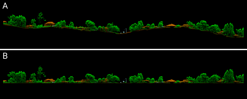
Figure 1. An example showcasing how a DTM can be used to normalise elevation to "height above ground"
A Building Height Model can be used to extract key structural attributes such as the slope and aspect of the building roof. Building Footprints can also be generated by vectorizing the initial BHM, complete with key height attributes extracted from the underlying elevation data.
While these products are all derived via full automation, a range of other bespoke infrastructure features can also be classified with manual intervention within the LiDAR point cloud and subsequently digitised to provide additional insights about assets such as powerlines, power poles and footpaths.
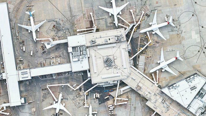
Geospatial datasets describing the precise location and geometry of buildings and other infrastructure, relative to the surrounding environment, are crucial in numerous applications. Shared below are a few examples of these use cases.
Flood Risk Modelling and Mitigation
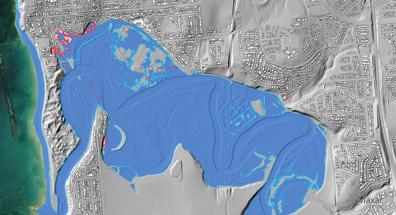
Knowing the relationship between regional topography and built assets in the region is one of the key insights required to understand and potentially mitigate the risks associated with flooding. The below figure shows how a Relative Elevation model can be used to identify buildings within a hypothetical 3.0 m storm surge.
Bushfire Attack Level Assessments
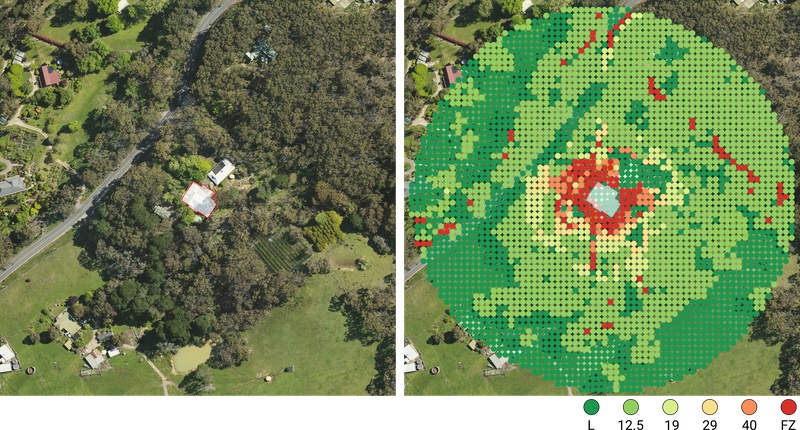
Critical to understanding the potential risk to a dwelling in bushfire-prone areas is assessing the Bushfire Attack Level (BAL) according to Australian Standard, AS 3959 - “Construction of buildings in bushfire-prone areas”. Building footprints extracted from airborne LiDAR, combined with a DTM, Slope Map and vegetation coverage can be used to calculate a first-order approximation of a dwelling's BAL, as shown in the figure below.
City Visualisation and Digital Twins
Airborne LiDAR surveys are an ideal foundational dataset to generate vectors such as building footprints that are tailored towards the development of large-scale digital twins. A single survey can provide vectors describing buildings, trees and other assets which can be combined into visual urban landscapes in interactive platforms.
Learn more about our other products & solutions:
Contact our team using the form below and we'll reach out to discuss your requirements.