Spatial intelligence that supports better urban planning, management and community outcomes

Local councils, urban planners and consultants need accurate, current spatial data to make informed decisions, manage developments and communicate effectively with communities. Aerometrex delivers aerial imagery, LiDAR and 3D modelling solutions that help councils and developers visualise, analyse and manage urban environments efficiently.

From precinct planning and urban greening to stakeholder engagement and monitoring, our solutions provide clarity and confidence throughout the project lifecycle.

lga metromap

Aerial Imagery

Current context for planning, engagement and monitoring

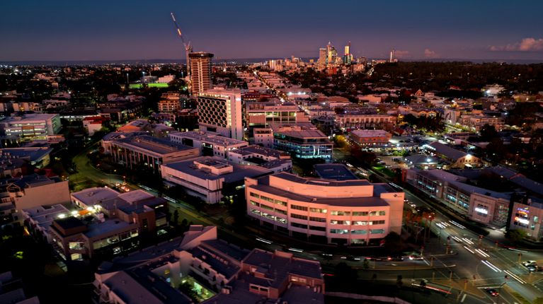
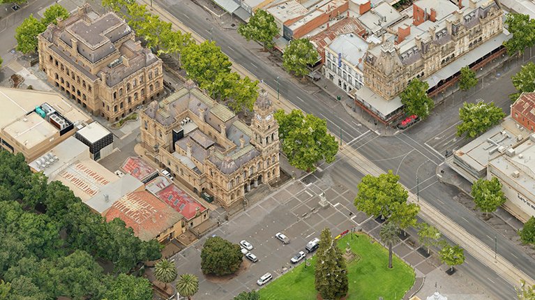
High-resolution aerial imagery gives councils and planners a clear view of urban areas, open spaces and infrastructure. With MetroMap, our subscription-based imagery platform, teams can access current, repeatable imagery alongside bespoke captures for specific projects. Imagery is delivered via web access or through APIs, making it easy to integrate into existing platforms such as Esri ArcGIS, CAD tools, or other GIS workflows.

Using this imagery, teams can:

  • Inform urban planning decisions – assess land use, site conditions and surrounding context.
  • Support development approvals – provide clear visuals for regulators, developers and communities.
  • Communicate with stakeholders – enhance reports, presentations and interactive consultation materials.
  • Track urban change over time – monitor construction progress, public spaces, and vegetation growth.
  • Integrate seamlessly into GIS and planning platforms – bring imagery directly into existing workflows for analysis, mapping and reporting.

MetroMap imagery is updated regularly across cities and regional centres, providing ongoing access for councils and planners.

GO TO METROMAP WEBSITE

lga lidar

LiDAR and Derived Solutions

Elevation, terrain and asset data for confident planning

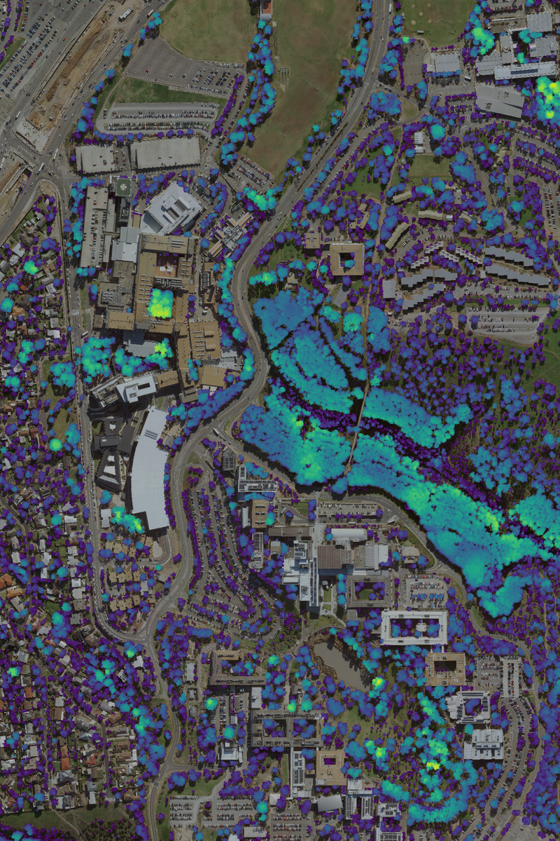
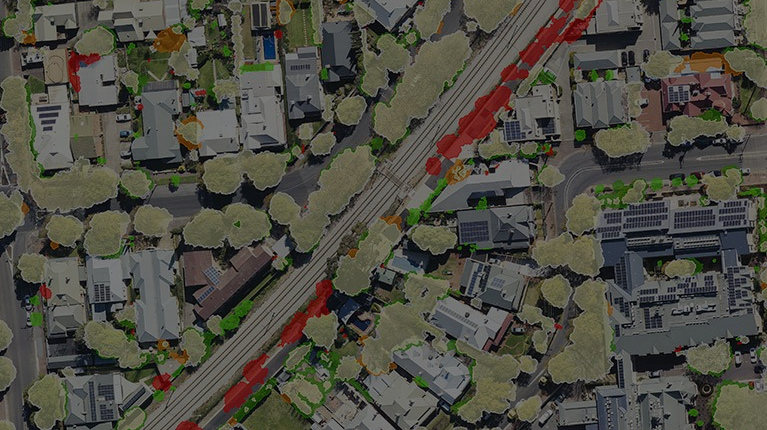
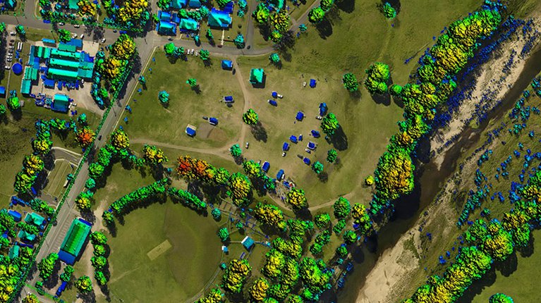
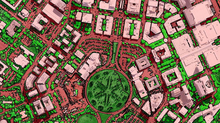
Aerial LiDAR provides accurate terrain, building and surface models to support urban planning, precinct development, asset management, and green infrastructure initiatives. In addition to classified point clouds, Aerometrex delivers elevation, vegetation and built infrastructure models tailored to project needs.

This data enables councils and developers to:

  • Understand terrain and site constraints – support flood modelling, drainage design and infrastructure planning.
  • Map urban assets – quantify buildings, vegetation and other critical features for planning.
  • Plan developments effectively – assess slopes, clearances and spatial relationships across precincts.
  • Support urban greening and sustainability – measure canopy, green rooftops, and green infrastructure for climate resilience.

LiDAR underpins repeatable, verifiable analysis for informed decision-making across urban projects.

LEARN MORE

lga 3d coastal

3D Mesh Reality Modelling

Bringing urban environments and natural landscapes to life for planning and engagement

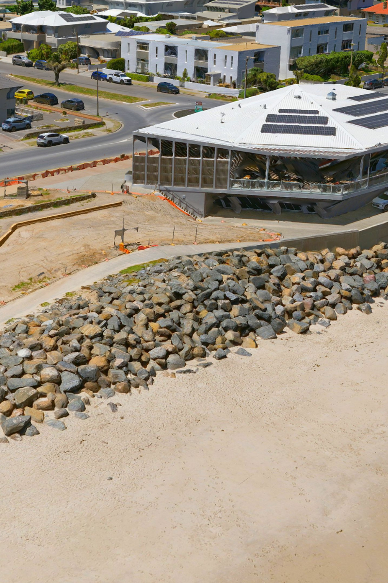
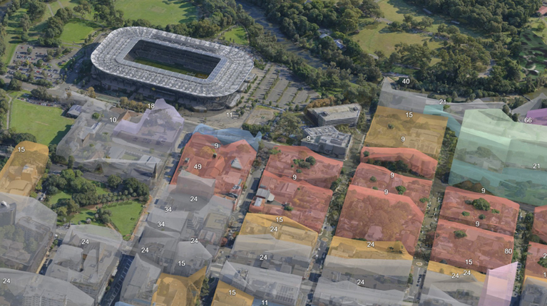
For local government, urban planners and consultants, 3D models are invaluable for planning, stakeholder engagement, monitoring and decision-making. Local councils across Australia are using 3D modelling to visualise complex proposals, streamline development approvals, improve asset management, and support community consultations with intuitive, immersive visuals. Councils also use 3D change analysis and volumetric monitoring in coastal and environmental management - enabling better insight into erosion, landscape change and infrastructure impacts.

Using 3D models, your team can:

  • Visualise precincts and developments – see how new buildings, infrastructure and open spaces integrate with the existing context.
  • Streamline planning decisions and approvals – identify zoning and compliance issues early and communicate intent clearly.
  • Support community engagement and reporting – interactive 3D visuals make complex information accessible to the public.
  • Monitor change over time – analyse multiple captures to detect transformation in urban fabric, vegetation, coastal and environmental zones.
  • Inform asset and risk management – integrate 3D models with planning systems to track infrastructure and support proactive maintenance decisions.

3D modelling solutions can also be delivered in formats and workflows that integrate with existing GIS, web platforms and APIs, or used with 3D building models and derived elevation products for enhanced analysis and simulations.

LEARN MORE

Projects

project
City of Subiaco: Enhancing Urban Planning with Aerometrex Spatial Data
City of Subiaco: Enhancing Urban Planning with Ae…
Western Australia
Read more
project
City of Unley: Urban Tree Canopy Change
South Australia
Read more
project
City of Parramatta Cuts Development Decision Time with Aerometrex 3D
City of Parramatta Cuts Development Decision Time…
NEW SOUTH WALES
Read more

OUR BLOG

blog
Using spatial data for better urban development
Read more
blog
Capturing our cities with multiscale 3D mesh models
Read more
blog
Greener, Cooler, & More Sustainable Communities How Spatial Data Can Help You Plan For the Future
Read more
X