Aerometrex delivers high-precision aerial LiDAR surveys that capture detailed 3D data of terrain, vegetation, and infrastructure.
Whether tailored to your project or sourced from our ready-made datasets, our solutions provide fast, accurate insights that help your business make confident decisions.
We can also include aerial imagery alongside LiDAR to add even greater value to your data.
Tailored LiDAR services for your specific location, scale, and project requirements.
From infrastructure to environmental monitoring, our aerial LiDAR capture is tailored to your needs. We handle every stage—from planning to delivery—providing reliable, high-accuracy data to support decisions.
Contact UsAccess existing LiDAR datasets instantly for fast, cost-effective results.
Our extensive library of pre-captured LiDAR covers locations across Australia. Delivered quickly and with the same high-accuracy standards as our project work, it’s a cost-efficient way to get the data you need.
View Coverage Map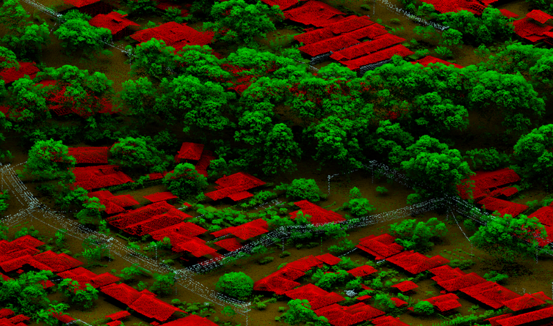
Our airborne LiDAR sensors create detailed 3D point cloud models by capturing millions of elevation points per second. These models can be colourised and classified to identify and measure natural and built features. This data is ideal for engineering, asset management, construction, environmental consulting, and emergency response, providing precise spatial information to support a wide range of projects.
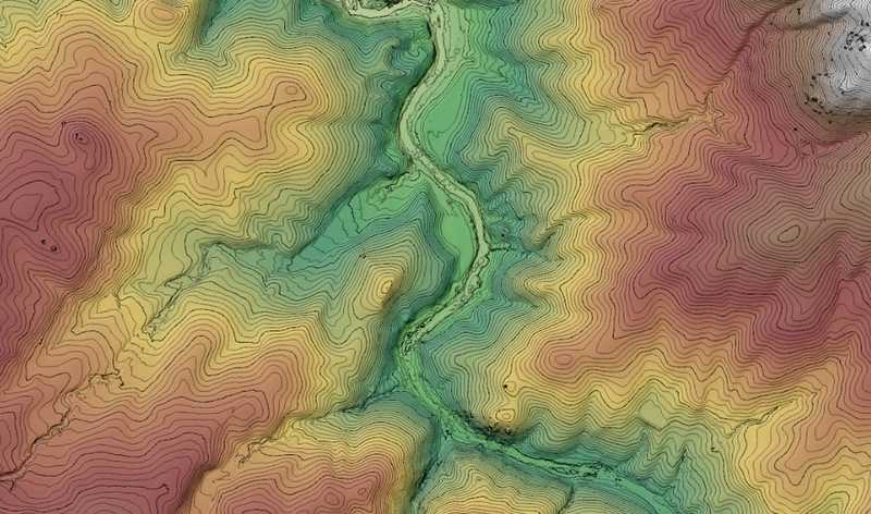
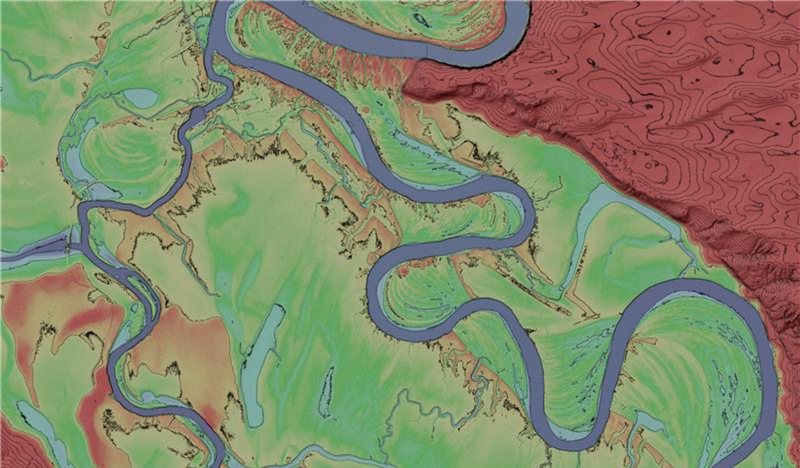
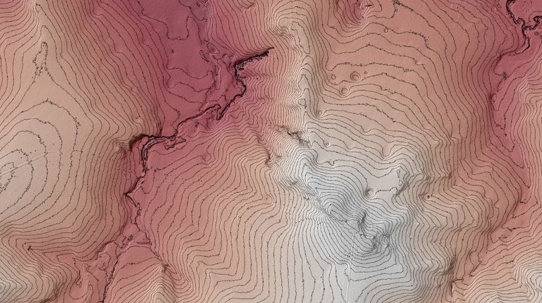
LiDAR can see through vegetation to create accurate ground surface models and capture above-ground features. We deliver various elevation products such as digital terrain and surface models, and contour maps. These datasets support local engineering, urban planning, mining, groundwater management, and flood risk assessment, offering highly accurate height information for confident decision-making.
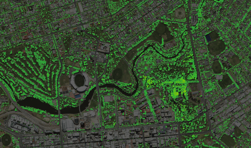
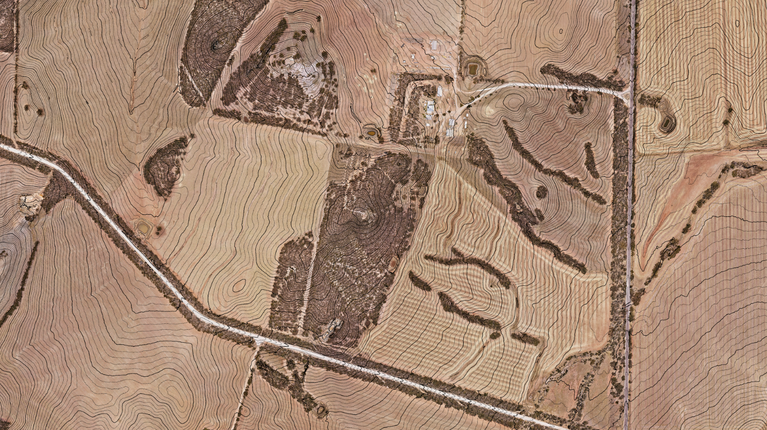
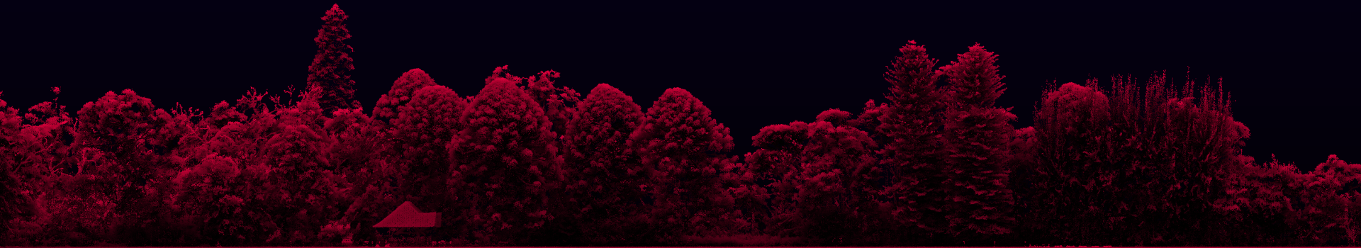
LiDAR is a proven tool for mapping vegetation distribution & structure across urban & rural areas. Our vegetation datasets include canopy height, foliage coverage, and tree canopy maps. These help forestry managers, urban planners, and environmental scientists assess vegetation density for informed land management, rehabilitation, and natural capital monitoring.
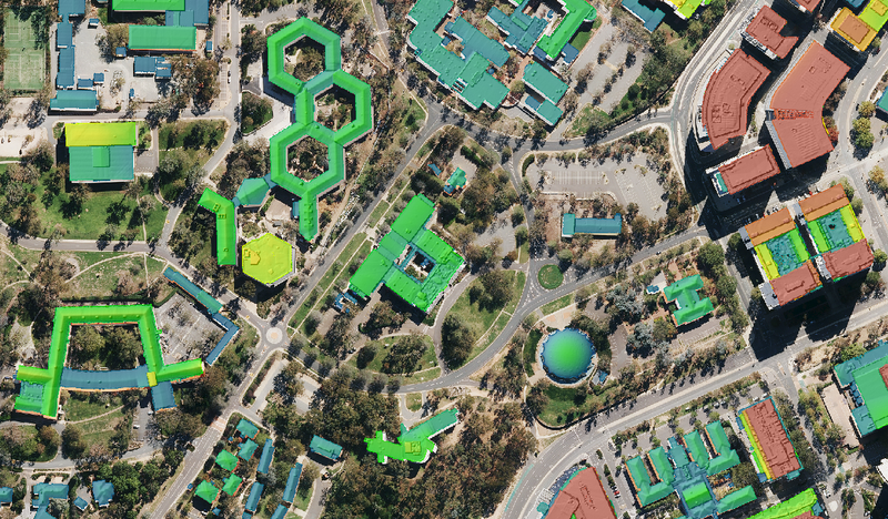
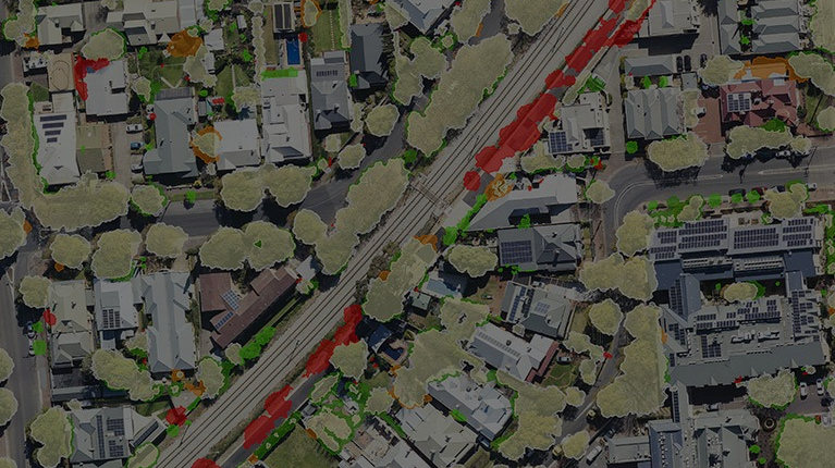
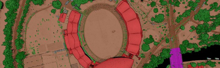
Using LiDAR data, we create detailed maps of built infrastructure, such as buildings. This includes 2D building footprints and height models that show the size and elevation of structures above ground. These datasets support urban planning, flood modelling, and bushfire risk assessment by helping stakeholders understand how built assets interact with natural hazards.
Alongside LiDAR, we can capture high-quality aerial imagery during surveys, offering a valuable visual reference to interpret 3D data. We also apply post-processing to improve image quality by balancing colours and removing distortions or shadows. This combined dataset gives a richer, clearer view of the landscape while keeping project costs efficient.