Spatial data acquired through Aerial LiDAR surveys can benefit mine sites throughout their entire life cycle. From pre-build planning to post-closure rehabilitation, accurate LiDAR and imagery-derived datasets can help build a more efficient, profitable, and compliant mining operation.
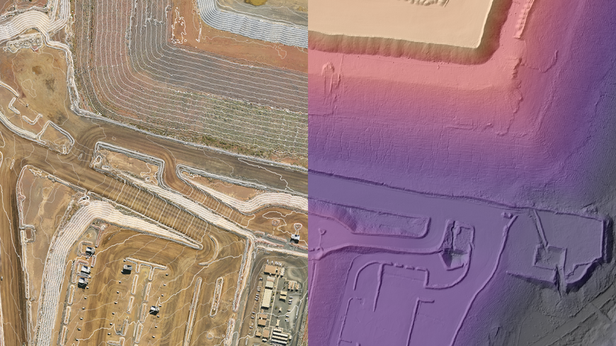
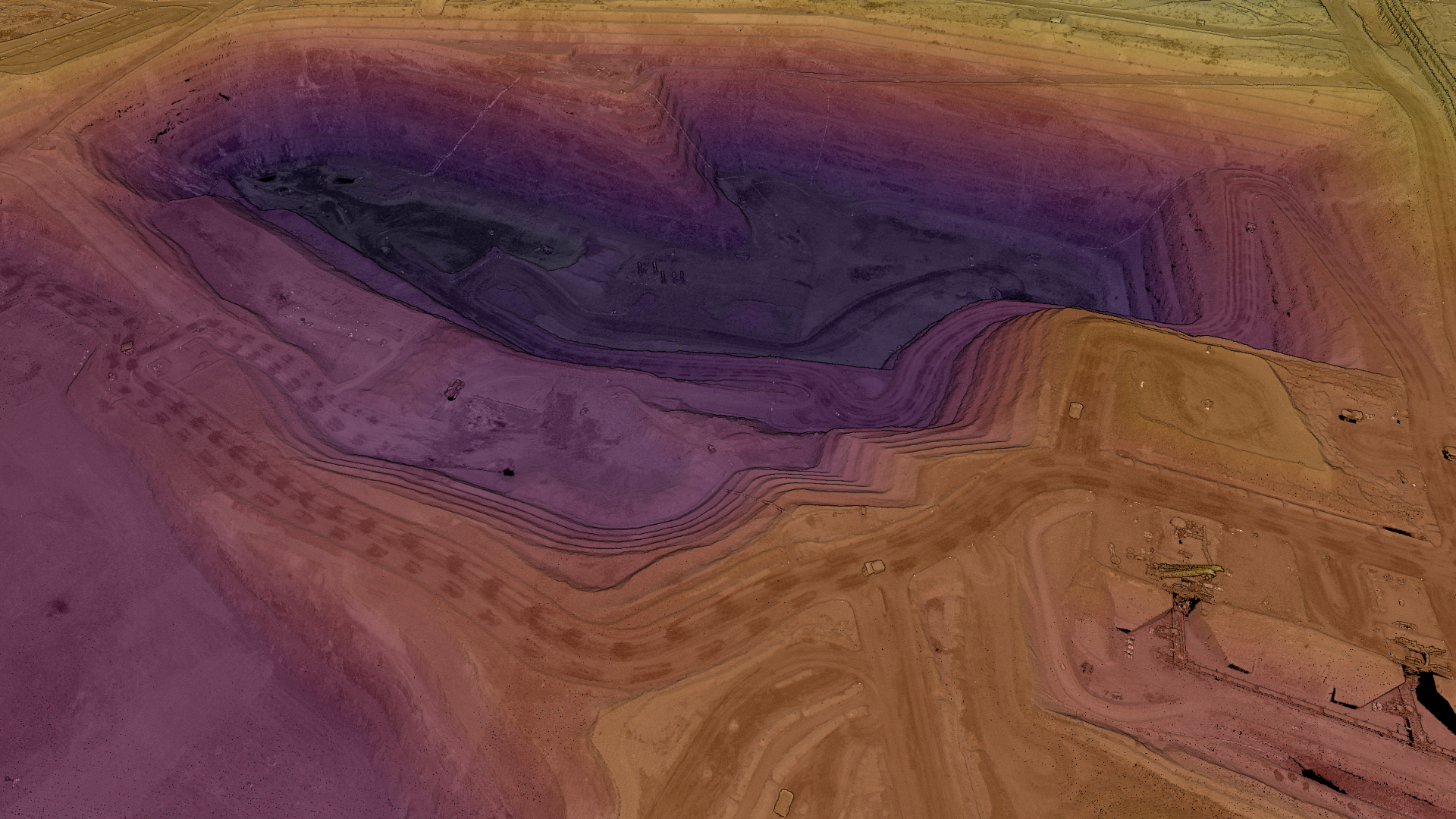
LiDAR provides highly accurate spatial measurements that can generate precise elevation datasets such as Digital Terrain Models (DTM), Contours, and Digital Surface Models (DSM). These datasets can help analyse surface features and target underground deposits during the exploration phase.
These ground and above-ground elevation datasets can also aid initial site planning stages, by helping mine operators model future development plans and virtual designs for site infrastructure, such as access roads, plant sites and support buildings.
Digital Surface Models are particularly useful for volumetric calculations such as stockpile estimation and change detection over sites. They can help assess a mine’s resource extent and plan stripping operations to quantify development costs.
Aerial surveys are a fast & non-disruptive way to measure & capture mine sites. Access high-density LiDAR & imagery to get the most accurate baseline data to start your site planning & modelling.
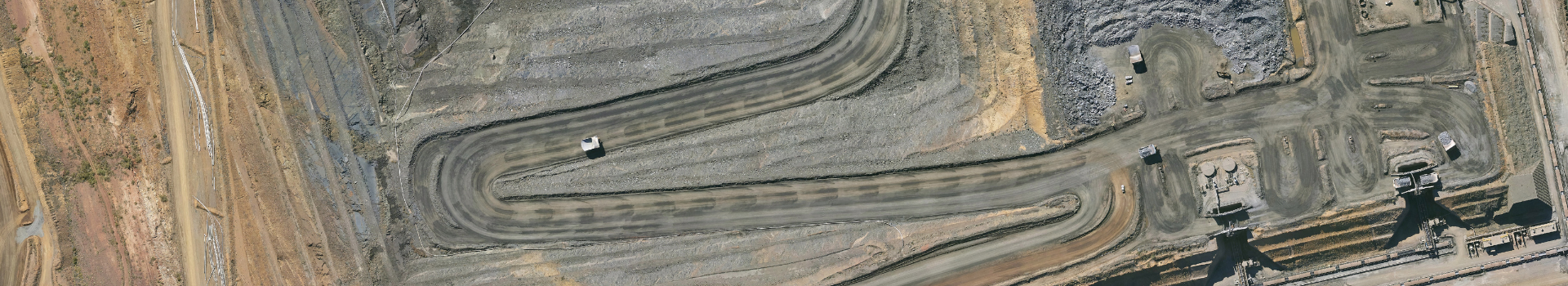
Regular LiDAR surveys during the operational phases of a mine site can provide detailed information for a more visual site management system. The LiDAR-derived point cloud can be classified to one of our standard classification types (or a custom standard required by the mine operator) so that every object on the mine site can be accurately identified and assigned attribute data.
LiDAR-derived elevation datasets can support flood management through hydrological studies and optimization of dam sites for the mine’s ongoing operations. They can also aid the design and maintenance of embankments and windrows using engineering studies derived from aerial survey data.
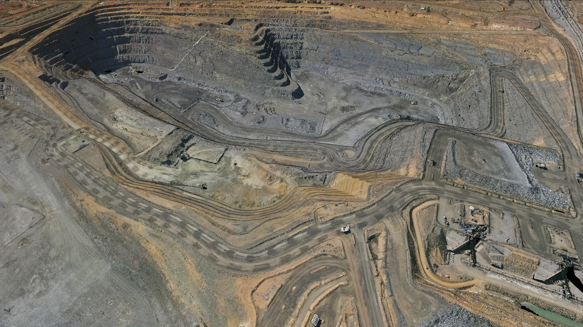
Aerometrex’s aerial LiDAR surveys can capture simultaneous imagery to increase its derivative value and offer another base map that is extremely useful for mine site project managers. These datasets in conjunction with LiDAR can reduce the number of on-ground manual surveys required, reducing operational disruptions, and increasing safety, thus saving time & money.
Building a baseline archive of the mine site before operations start, to record the current landscape and features such as canopy definition can support benchmarks for disturbance mapping and mine rehabilitation plans at the end of the mine site’s life.
Aerometrex’s LiDAR-derived vegetation data suite is ideal to accurately measure vegetation coverage, structure, and density from tree canopy to ground. Changes in vegetation levels can be tracked across time to aid with environmental risk management, monitoring, reporting, and necessary regulatory submissions/approvals over time.
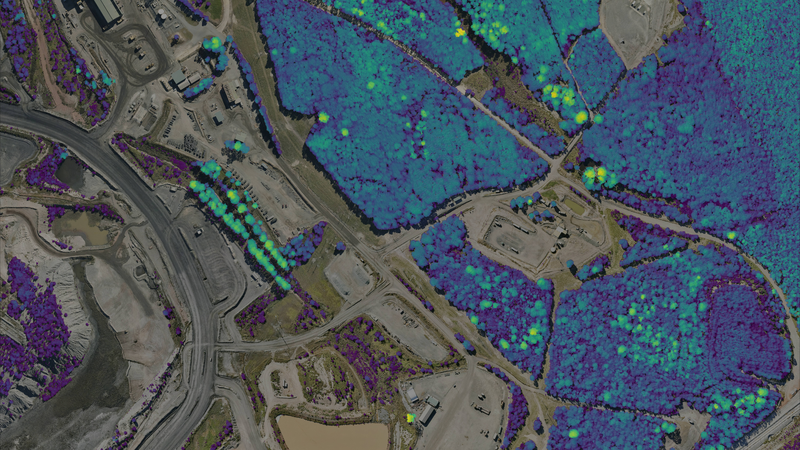
Image. Canopy Height Model - a raster dataset that describes the precise height (above ground) of the top of tree canopies.
Aerial surveying has grown in popularity within the mining industry for a good reason; it simplifies major tasks that depend on the precise measurement of large areas. Mine sites change constantly and rapidly and have stringent planning, safety, reporting, and efficiency requirements.
Aerometrex can operate under site-specific compliance requirements including BARS. Our services and client list have grown to reflect the modern operational needs of mine sites. Speak to our team by filling out the below form to discuss your specific requirements.