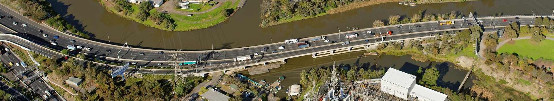
From conception to completion, large-scale infrastructure projects need accurate, up-to-date datasets – so developers can make more informed decisions with precision. Digital twins make it possible. These real-time replicas use static and dynamic layers of geospatial data and information to build a virtual 3D environment, giving a glimpse into what’s happening now – and what might arise in the future. This helps streamline every stage of development, anticipate challenges and pinpoint potential impact, saving significant time and money.
A digital twin is simply a virtual replica of a real thing, such as a train, a turbine or a town. Creating a digital twin can also mimic a process, service or system. By rebuilding the asset as a 3D mathematical model, we can test scenarios and use the data to make better decisions and predictions.
Armed with real-time spatial data, developers, councils and government can design smarter sustainable cities for the future. There are three ways we can do this: with semantic 3D models, mesh models, or a combination of both.
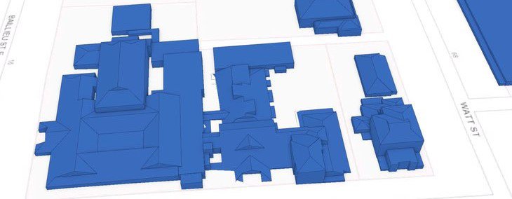
Semantic 3D models
Semantic 3D modeling shows individual objects, using simple geometry and rich data to offer different levels of detail (LOD). For instance, LOD0 gives the basic footprint of a building, LOD1 digitises the building block with a flat roof, LOD2 adds the roof slope, while LOD3 has furniture and features. With the help of semantic segmentation, we can assign attributes to individual buildings, turning them on and off to plan building height, volume and floor space, as well as visualise entire streetscapes.
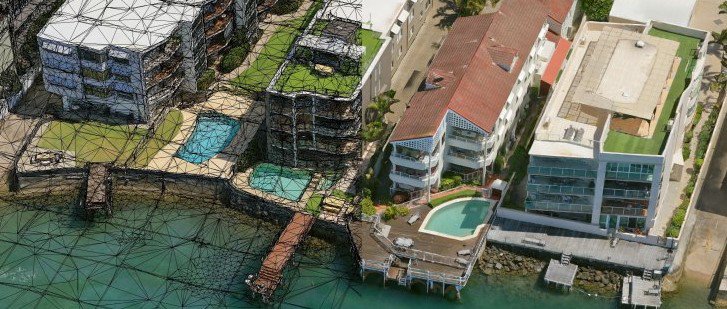
3D mesh models
For richer, realistic datasets, we turn to 3D mesh models. These use photogrammetry to create a complete and continuous mesh (as opposed to individual objects), draping the imagery over everything in the scene, including trees and power lines.
At Aerometrex, we've developed a solution powered by artificial intelligence that automatically segments and classifies objects within the 3D mesh. This offers a precise photorealistic model with rich analytic capabilities so that you can make better business decisions with 3D context.
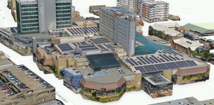
Dual 3D models
For the best of both worlds, some cities are combining both 3D semantic and mesh models. This involves digitising and texturing the LOD model with rich imagery – like the models we produced for the Victorian State Government’s Fishermans Bend project. We populated LOD2 buildings with critical information (such as specific heights, materials and positions) and then used our in-house algorithm to wrap them with 2cm helicopter imagery.
Blending both approaches also allows for good data coverage and deep learning, without blowing the budget. Developers can get a generalised snapshot of a larger area, with a higher level of detail of localised areas where precise insights are needed.
As we move into a post-pandemic world, cities will need to evolve and adapt faster and better than ever before. Here in Australia, the $2.5 billion Central Place Sydney Project is the city’s most significant development in over a decade. It follows the biggest proposed shakeup of planning controls in over 40 years, with approved rezoning allowing buildings up to 206 metres high – compared to the current 35-metre limit.
Part of the government-backed technology precinct designed to stimulate the economy, the fast-tracked project will comprise over 230,000 square metres of office space, powered by 100 per cent renewable energy, as well as artificial intelligence and other sustainability initiatives.
With our highly detailed, accurate model of the area now available off the shelf, developers can plan, design and build using the most up-to-date spatial information. It will also serve as a snapshot in time, capturing the 3D city model before its radical redevelopment.
As well as project planning, 3D modelling can also support stakeholder engagement and community consultation.
Queensland’s largest infrastructure project, Cross River Rail, was the first of its kind in Australia to integrate BIM, GIS and 3D modelling, using the datasets to guide discussions and decisions across the entire development lifecycle.
With the Cross River Rail Delivery Authority (CRRDA) committed to placing digital modelling at the centre of everything it does, we began with a detailed 3D model of the entire rail line, tunnel and stations. The datasets needed to be as precise as possible – and free from cloud, smoke, haze and processing distortions. This was then fed into an easy-to-use gaming engine for real time performance.
Looking ahead, the CRRDA can use the 3D visualisation to collaborate with stakeholders, attract investors, simulate scenarios and plan as the project progresses – as well as virtually tour the space before building to ensure it meets crowd control, accessibility and other requirements.
The future of digital twin technology
In our 40-plus years creating foundational datasets for critical projects here and overseas, we’ve been excited to see 3D city modelling revolutionise the construction and infrastructure sector – and play a part in what’s to come.
If you’d like to integrate digital twin technology into your next critical project, get in touch with us today.