
15 Apr, 2021
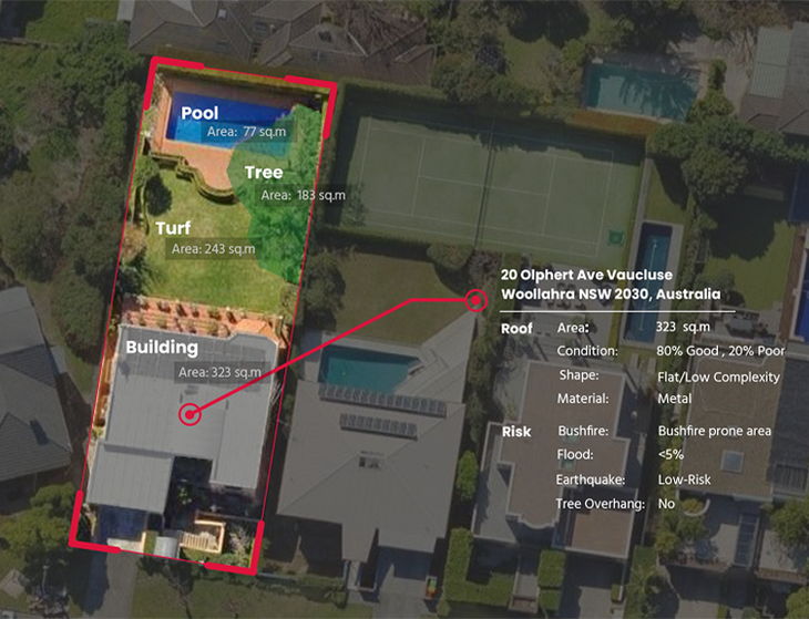
Mapizy property analytics platform unlocks the power of AI and HD aerial imagery for insurance businesses helping them to make informed decisions faster. It combines current building attributes with change analytics and risk factors allowing insurers to better assess properties, underwrite more accurately and achieve customer base growth. [Image Courtesy: Mapizy]
Having access to our rich and frequently captured MetroMap image library will enable Mapizy to provide insurance carriers with the latest and most accurate property analytics and change insight across Australian urban environments.
“I have been working with Aerometrex for over 10 years in various contexts and believe they are leaders in providing high quality aerial images and elevation data.'' said Mapizy CEO and Adjunct professor, Dr Mehdi Ravanbakhsh.
Managing Director at Aerometrex, Mark Deuter says, “We are pleased to be partnering with Mapizy in the provision of high-quality analytics from our MetroMap aerial imagery database. The value that can be extracted from our data is profound and Mapizy offers a rich range of property and risk attributes which are in demand by an increasing number of industries. Starting with a high-quality, high-accuracy image data source provides high-quality outputs and reduced error rates.”
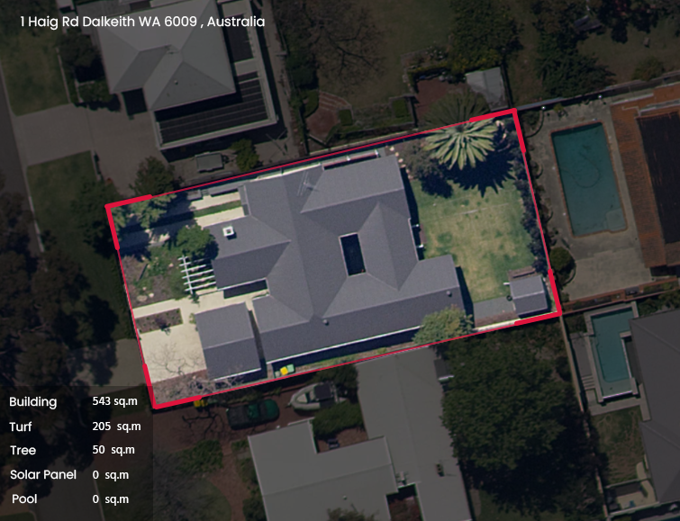
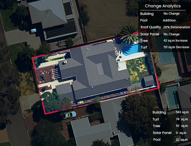
The below swipe tool showcases the change analytics that are provided via the Mapizy platform, using MetroMap's image library [Images Courtesy: Mapizy]
Mapizy is a geoAI company focused on quantifying the changing planet through image data. Their property analytics platform, is the first of its kind in Australia providing on-demand analytics about properties, risk factors and change insight. The platform was awarded by leading organisations like Deloitte, IAG and RAA during the global Gravity Challenge program and offers flexible subscription models through desktop apps and APIs.
Aerometrex Ltd. is a geospatial tech company with a focus on providing data-driven insights for a range of industries. The company has over 40 years of experience in aerial imagery and mapping, 3D modelling and airborne LIDAR. It also offers a subscription-based service known as MetroMap, which gives users easy access to high-quality 2D imagery, 3D reality mesh models and LIDAR-derived products.