05 May, 2021
Aerometrex used the 2021 NSW Flood Emergency to develop a range of fast-response analytics services to support emergency recovery and make them available for free to enterprise and government users through our subscription-based MetroMap platform. This timely service is part of Aerometrex's capacity-building strategy to deliver rapid and diverse geospatial datasets following emergencies.
The increasing frequency of extreme weather events, added to population growth and urban sprawl, forces response services to find ways of working faster. Aerometrex's involvement in previous emergencies showed a need for faster measurement and delivery of data to instruct faster decision-making and rapid resource deployment.
Government and private industries that support recovery efforts need relevant data that quickly inform actions. That means generating platform-agnostic and non-proprietary datasets that are packaged and ready for the end-user. The Aerometrex team's prior work with government, emergency services, and insurance companies has shown the importance of client-focused data delivery to minimise handling and ingestion times. The ultimate goal was faster assistance for people directly impacted by the floods.
Aerometrex developed the flood data analytics with the support of critical data from our partner, Geoscape Australia, and flood extents derived from COPERNICUS Emergency Management Services (CEMS).
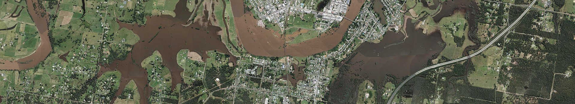
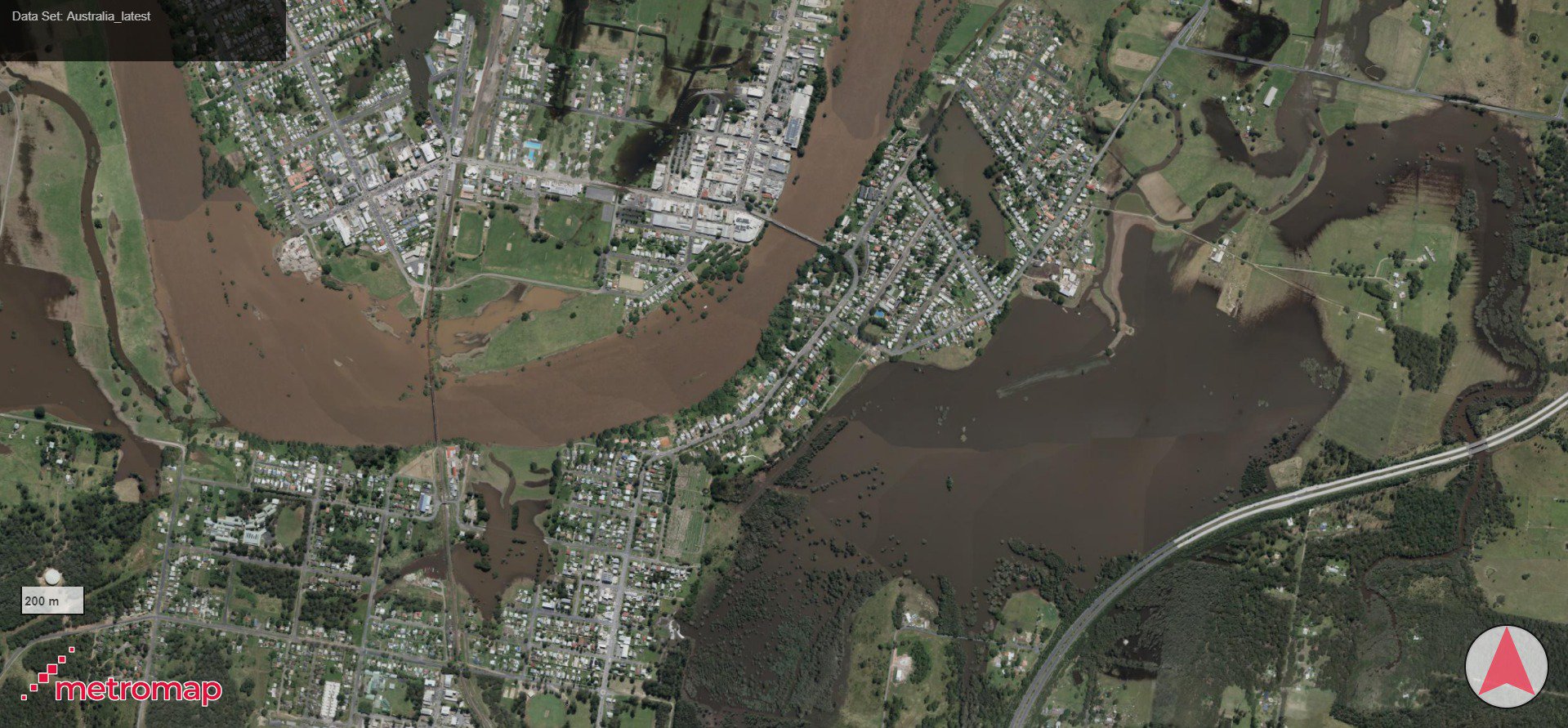
Aerial imagery was also captured for parts of NSW and uploaded to the MetroMap platform within a few days of the flooding, in addition to the flood layers described above. All data outputs were processed and turned into MetroMap feature data layers:
Aerometrex Managing Director Mark Deuter said, "The scale of this disaster made it extremely difficult to identify and assist individual people who have been affected on a case-by-case basis. The advanced analytical techniques developed by our team and supported by our data partner, Geoscape, helped us provide this information within days of receiving the satellite imagery. This is an outstanding example of the analytical power and capabilities of MetroMap platform to provide mission-critical data, in this case supporting the reconstruction and recovery process following the NSW floods."
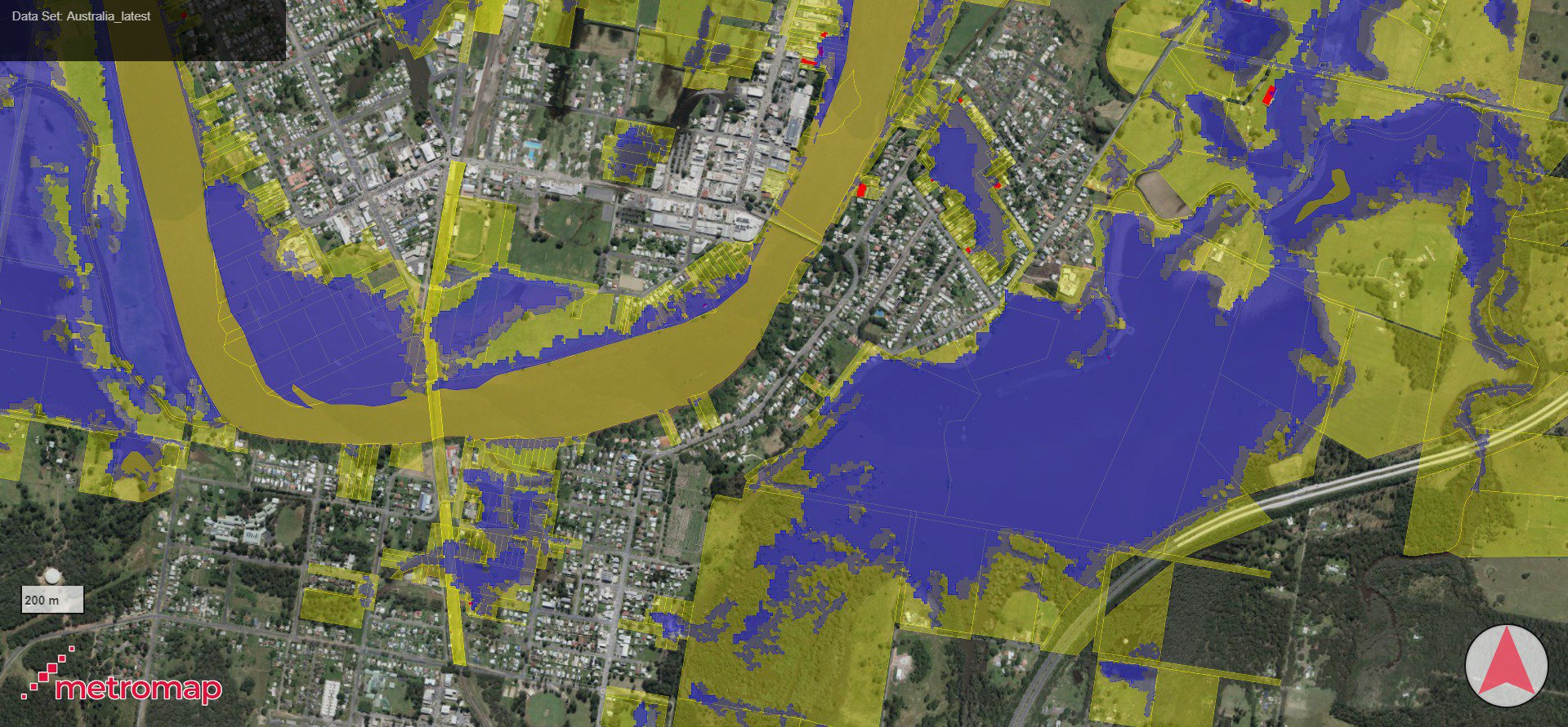
Emergency Flood Overlays (in image above) - Flood extent in blue, Cadastral/Flood Extent Intersect in yellow, and Building/Flood Extent intersect in red.
The mixture of data helped quickly identify individual properties and buildings that were potentially affected by floodwaters. The intersection of floodwaters with cadastral parcels and building footprints makes large-scale appraisal much faster. Most flood-affected properties and buildings could be identified quickly with these MetroMap layers. These layers also showcased precise flood extent within urban areas.
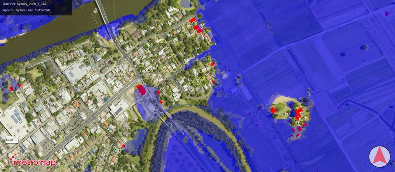
The flood extent shown in blue and intersecting building footprints shown in red.
All flood extent data was free to access for enterprise-level and government MetroMap subscribers for a crucial two-week period after the catastrophic event. This subscriber base included critical emergency response organisations directly involved in the recovery and response:
"Geoscape location data combined with MetroMap imagery from Aerometrex is an incredibly powerful tool for emergency planning and response management. It enables authorities to pinpoint individual addresses and buildings likely to be impacted by flooding. We were excited to see Aerometrex integrate our unique Geoscape Buildings data with flood extents from CEMS to help with the New South Wales emergency response. The service showcases the power of geospatial data to create valuable solutions."
Geoscape Chief Business Officer, Martin Rose.
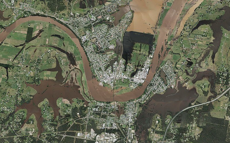
This orthoimagery capture of Kempsey was added within 4 days of capture as part of our emergency ortho capture.