
28 Jul, 2022
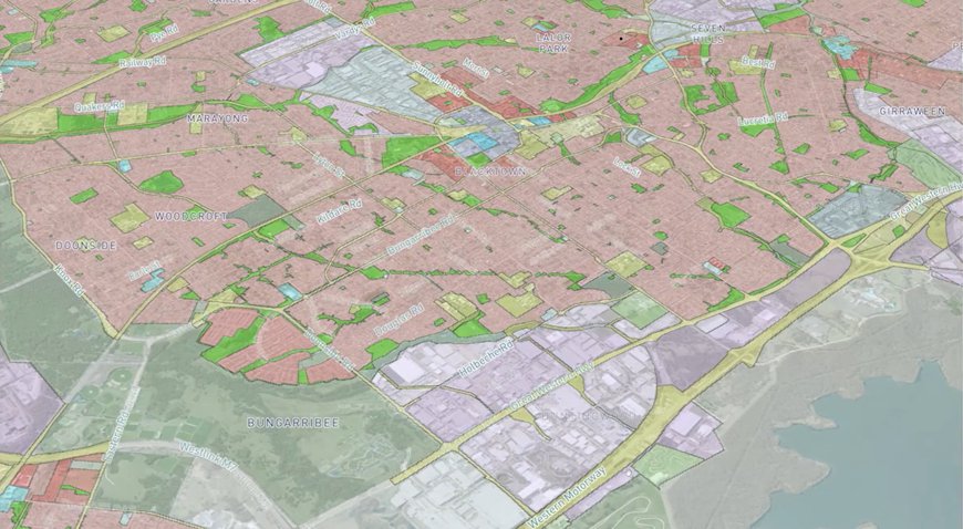
The NSW government has launched Land iQ, a data platform set to revolutionise the planning system and help the government make smarter, faster decisions about land use. It pulls in data from multiple sources to assess the size, location, and zoning constraints and cut the assessment of a site for potential development to just minutes. The platform was built by WSP Australia and NSW start-up Giraffe, with high-resolution maps provided by Aerometrex’s aerial imagery solution, MetroMap.
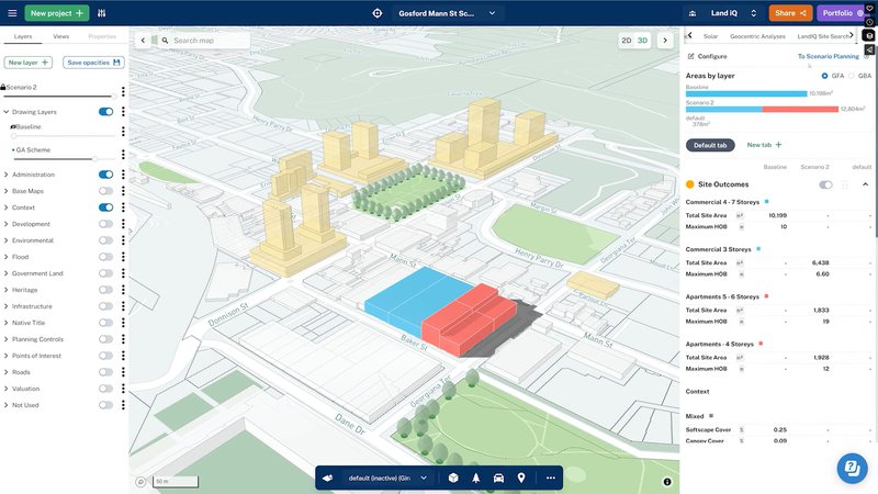
The platform has 4 primary capabilities that allow for rapid analysis of different land use scenarios. Video Source: Department of Planning and Environment, NSW Government
“Until now, government agencies have used various methods, tools and systems for land use analysis – it’s inconsistent, broadly manual and inflexible,” NSW Planning Minister Anthony Roberts said. “Agencies can bring together more than 100 datasets from a range of sources to find sites that meet development requirements, then virtually test and learn how different planning scenarios perform in a specific place or region.”
The system is already being used as a database available to all government departments, helping to avoid duplication of basic planning information. Transport and Education are using Land iQ to consider options for development sites, and the Treasury Department is considering how it could be used to assess the influence of electricity infrastructure corridors. “In its emergency accommodation response to the Northern Rivers floods that hit the Lismore region and displaced thousands of people in February and March, the department used Land iQ to analyse the risks of potential sites for new housing and inform the site layouts as new flood and damage information came in in real-time.”, said James Strutt, the Planning and Environment Department’s director of property strategy and data analytics.
WSP is delivering the project in partnership with Giraffe and Aerometrex. The team brings together the expertise required to deliver this ground-breaking project for the state of NSW. According to Gustaf Jonsson, Digital Interdisciplinary Lead at WSP, “Our combined strengths in effective stakeholder engagement, holistic land use planning, applied software engineering, and data science are enabling our team to deliver an innovative tool to support enhanced strategic decision making. Our partnership with Giraffe and Aerometrex is essential as we develop the NSW Government’s vision of Land iQ to its full potential.”
Learn more about Land iQ here
To stay up to date on other MetroMap projects and developments, follow the MetroMap LinkedIn Page
Project Partners: WSP Australia, Giraffe