With an area of 30 sq. km. and set beautifully between the Pyrenees mountains and the ocean, Pau is the main city of the Pau Béarn Pyrénées Agglomeration council (which spans 31 councils and covers close to 400 sq. km.) Known as “The City of Art & History”, Pau has always had an innovative & progressive approach to adopting new technology. As part of their smart city approach, the agglomeration council actively develops and maintains a repository of digital data to improve knowledge, management and the prospective development of its heritage and its territory.
After a world-wide capability search and an international competitive tendering process in 2019, the agglomeration commissioned Aerometrex and its partner French company IGO SAS to produce a 3D model of the old city, including its historic castle, at a resolution approaching a few millimetres in pixel size. Aerometrex began working on the project in June 2019 and the final 3D model was released in the beginning of 2020.
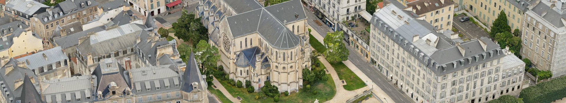
This 3D city model of Pau, Southern France, is a multi-scale 3D mesh model generated from helicopter, drone and ground level capture
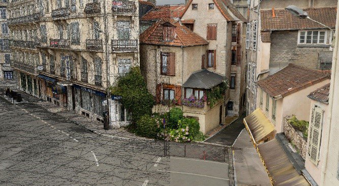
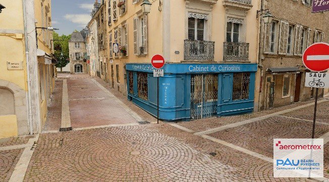
This project was a ground-breaking implementation of the science of massive multi-ray photogrammetry, involving the geometric reconstruction of more than 100,000 2D images taken from helicopter, drone and on foot. The model delivered resolutions ranging from 2cm up to 3mm, all stitched into a single 3D city mesh, enabling seamless interaction by users. The ability to process this massive volume of data (over 5TB) generated by these 3 perspectives over a whole city centre into a photo-realistic 3D environment provides users with an unparalleled immersive visual experience. The City of Pau was captured from a helicopter platform by Aerometrex and completed with drone captures over specific landmark buildings such as the Castle as well as street-level capture in the old town.
Triangulation was performed using the powerful capability of Agisoft Metashape and the reconstruction of the 3D mesh performed in Bentley ContextCapture. Artefacts such as cars, people and distorted glass windows and facades were corrected to generate a clean, accurate and seamless multiscale 3D mesh. The resulting 3D meshes were integrated into the interactive 3D platform Skyline TerraExplorer Pro/SkylineGlobe along with additional GIS information and geospatial data to provide internal and external stakeholders with a desktop/online data portal and powerful 3D capabilities including analysis, design and communication tools.
Jean-Michel Lopez, the Project Manager from the client’s side highlighted the multitude of opportunities that this 3D model opens to their community, businesses and individuals. Some of these are listed below:
This project illustrates the global reach of Aerometrex’s 3D modelling service as well as the degree of 3D technical excellence that now exists in the company.