
In this webinar, presented at Spatial Information Day 2021, Dr Sam Holt shows how spatial data is helping to measure the urban forest and plan for more sustainable urban development.
This webinar was presented at Spatial Information Day (SID) 2021, Friday 27 September 2021
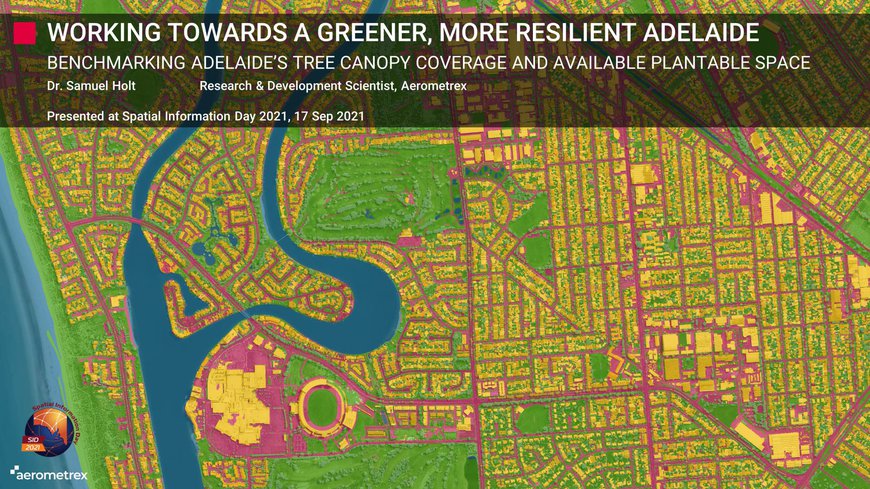
Benchmarking Adelaide’s tree canopy coverage and available plantable space using Airborne LIDAR and Deep Learning.
Preserving and increasing urban greenness, vegetation and urban tree canopy cover has become one of the most critical considerations for strategic planning within local government organisations. Urban trees and community green spaces have been identified as an important tool that can be used by policymakers to mitigate the many negative environmental effects of urbanisation and the environmental hazards associated with ongoing climate change, including Urban Heat Islands. As the scientific community’s understanding of the importance of the cooling effects of trees within urban environments has increased, so have the efforts of national, state, and local governments to measure, assess and increase the number of trees and green spaces within their government areas.
Aerometrex, in close collaboration with the Department of Environment and Water, Green Adelaide and sixteen individual metropolitan Councils, has undertaken a city-wide assessment of Adelaide, measuring both the tree canopy coverage and available plantable space (ground surfaces suitable for tree planting). The core objective of this project was to provide both state and local governments with a robust, spatially explicit benchmark from 2018 to be used to assess the progress of current greening initiatives as well as to develop more robust, achievable targets for the coming years. Aerometrex developed a novel methodology that combines both Airborne LIDAR data and high resolution four-band imagery (R:G:B:NIR) using traditional geospatial analyses as well as innovative deep learning methods.
Tree canopy above three metres in height (the height above which a tree provides cooling benefits) was extracted directly from the three-dimensional LIDAR point cloud at the city-, council-, and suburb-scale, providing quantitative measurements of the proportion of each area of interest covered by tree canopy and what land use and land ownership types it covered. The amount of available plantable space was assessed using a full semantic classification of permeable and impermeable surfaces within the urban environment using an end-to-end trained Feature Pyramid Network. For the purpose of this study, permeable surfaces (bare ground & grass), not already covered by tree canopy, were considered as plantable space.
In Adelaide in 2018, at the council level, tree canopy coverages in 2018 ranged from 9.9% (Pt. Adelaide Enfield) to 48.8% (Mitcham). At the suburb level, tree canopy coverages ranged from 1.7% (Parafield) to 71.8% (Waterfall Gully) and the proportion of ground available for the planting of new trees ranged from 6.4% (Mile End South) to 77.9% (Parafield). Of critical importance is the fact that at in 2018 the majority of both tree canopy cover and plantable space resided on residential land use areas and privately own land, especially within suburbs that are considered to be most at risk environmentally (low tree canopy coverage and low plantable space).
The results of this study highlight the important role of the community, not just councils and state government in building a greener, more sustainable, resilient Adelaide. Both urban development policies and greening initiatives need to be tailored in order to preserve existing trees, as well as to promote planting of new trees, on residential and private land.